
From 23–27 June 2025, the GoldenRAM team from the Federal Institute for Geosciences and Natural Resources (BGR) was involved in intensive fieldwork in cooperation with Savannah Resources at the open pit NOA of Savannah’s lithium mine in Barroso, Portugal. The mission was to test and advance mineral mapping technologies that can help identify and monitor lithium-bearing minerals directly at the mining face.
Cutting-Edge Equipment in Action
To capture the mineralogical complexity of the Barroso mine, the team relied on a combination of airborne, terrestrial, and ground-based instruments. The central tool was the HySpex Mjölnir VS620 hyperspectral UAV system, which operates across the 400–2500 nm range. It was flown both in the traditional downward-facing, or nadir, mode and in a novel 45° off-nadir configuration, enabling the UAV to capture far more detail from the steep mine walls than conventional flights allow.
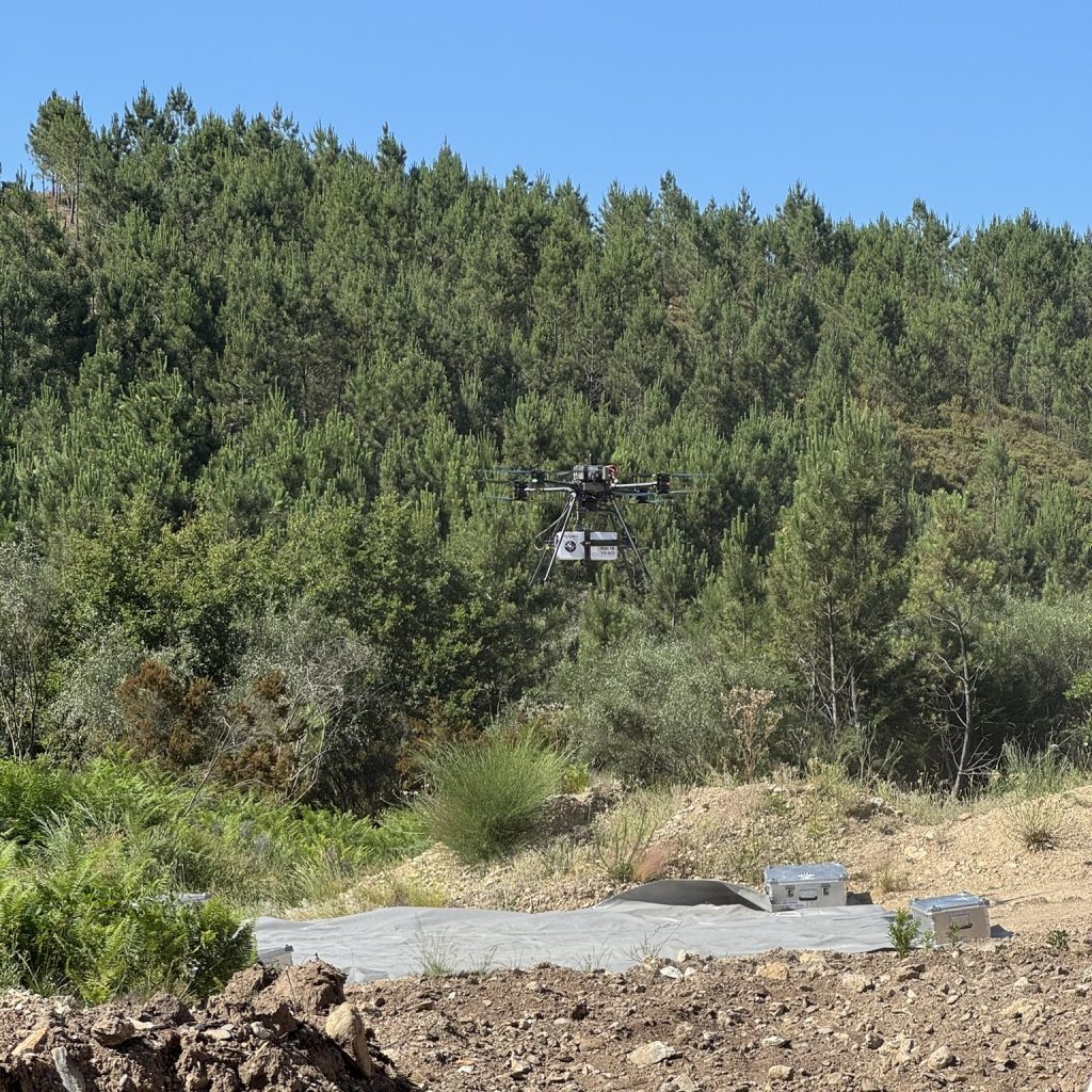
Start of the hyperspectral imaging UAV HySpex Mjölnir VS620
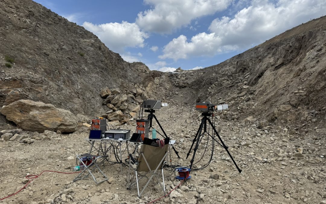
Complementing the UAV surveys, two terrestrial scanner systems were deployed: the AISA Fenix, which covers the 400–2500 nm range, and the AISA Owl, extending into the longwave infrared (7800–12300 nm). Operating at close distances to the exposed walls, these scanners delivered ultra-high-resolution data with pixel sizes as fine as 1.7 cm.
On the ground, the team also employed the Spectral Evolution PSR+ field spectrometer. This handheld instrument was used to calibrate and validate the remote sensing data, while also guiding the collection of rock samples. These samples will undergo laboratory-based mineralogical and chemical analyses, ensuring that the spectral signatures observed in the field can be linked directly to their mineralogical origins.
Focus on Lithium-Bearing Spodumene
The primary target of this campaign was spodumene, a lithium-bearing pyroxene mineral. Its diagnostic spectral features occur in the longwave infrared (LWIR) region, making the AISA Owl system particularly valuable for direct detection. At the same time, data from the VNIR-SWIR range were collected to test whether spodumene could also be mapped indirectly through secondary spectral indicators.
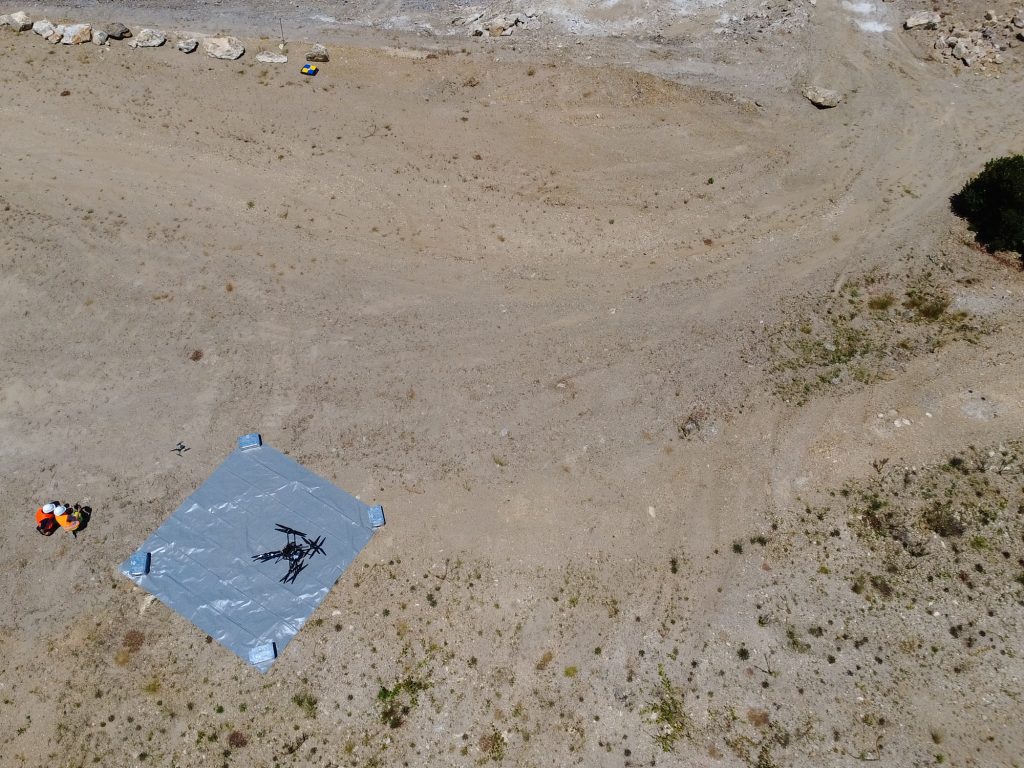
Launch site of the hyperspectral imagine UAV HySpex Mjölnir VS620
By combining multiple instruments and approaches, the team aims to refine methods for reliably mapping the spatial distribution of spodumene within active mining walls, a crucial step toward more efficient resource exploration and monitoring.
A Novel Data Acquisition Approach
One of the highlights of the campaign was the first-time use of the off-nadir UAV data acquisition geometry at BGR. By tilting the sensor 45° instead of the standard downward-facing mode, the UAV could capture much larger parts of the vertical wall surfaces. This approach offers exciting potential for increasing coverage and detail in mining environments where vertical exposure is common.
From Field to Analysis
Over the course of the campaign:
- Two mining walls were scanned with both airborne and terrestrial systems.
- UAV hyperspectral data were acquired with a spatial resolution of 6–8 cm per pixel.
- Field spectroscopy was carried out to calibrate the datasets and to validate results with collected rock samples, which will undergo mineralogical and chemical laboratory analysis.
All datasets are now being pre-processed into orthorectified reflectance data and are currently under evaluation.
Looking Ahead
The results from Barroso will contribute directly to GoldenRAM’s mission of developing innovative, reliable tools for responsible raw material exploration in Europe. By testing new acquisition geometries and combining multi-scale hyperspectral and field measurements, the team is adding valuable knowledge to ongoing efforts in mineral mapping workflows.
Banner image: Terrestrial set up of hyperspectral imaging systems AISA Fenix and Owl within the open pit