
Technologies

The GoldenRAM Graphical User Interface (GUI) enables users to engage with geospatial data via natural language queries, enhancing accessibility and ease of use. This capability simplifies data retrieval and analysis processes. Data is indexed within the PostGIS database, optimizing query performance and document retrieval. Users employ natural language queries like “show me,” “like,” “all,” “near” “since” “between” and “in” to locate data. The natural language queries result in data retrieval in both a tree-like folder structure and comprehensive Table view. GoldenRAM is European technology for Europe!

AI Knowledge Packs (AIKPs) are modules within the backend component (OCLI) of the GoldenRAM platform, streamlining data operations, enabling efficient handling and analysis of diverse datasets for informed decision-making. They handle data acquisition, image preprocessing, generating analysis-ready data cubes, facilitating multi-source data fusion and AI analytics. More precisely, the analysis-ready data cubes are prepared by cleaning, transforming, and filtering as necessary, while AI-based analytics are tailored to specific use cases. The AIKPs deliver visualized outputs through a Graphical User Interface in the form of lightweight COG files. There are currently 22 available AIKPs able to perform unsupervised cluster mapping, spectral indices calculations, RGB composites, oRVI calculation and time series, volume difference over time, and principal component analysis.

Satellite data offers numerous benefits to the mining industry, significantly improving operations, environmental monitoring, and exploration efforts. High-resolution imagery and geospatial information enable precise mapping of mineral deposits and terrain analysis, aiding in the identification of promising exploration sites. This data can also assist in planning infrastructure and logistics by providing detailed views of remote areas. Environmental monitoring is enhanced as satellite imagery allows for the detection and assessment of changes over time, helping to ensure regulatory compliance and mitigate environmental impacts. Furthermore, satellite data supports risk management by monitoring conditions such as subsidence, water quality, and vegetation health around mining sites.

Aerial sensing of mining areas will utilize several drone imaging systems. For example, drone hyperspectral imaging can be applied to mineral exploration and vegetation health monitoring around tailing ponds. Vegetation and habitat mapping of mining area is performed using time series of vegetation indices with multispectral and hyperspectral imaging. Synthetic aperture radar (SAR) and thermal camera flight campaigns are performed for production, operation and safety applications of project mines. Drone SAR can provide water depth information of tailing ponds. Drone LiDAR data is suitable for testing dam stability and tailing storage facility accumulation.

GoldenRAM makes use of technologies like Hyperspectral imaging and Raman spectroscopy that enable the simultaneous mapping of REEs and their host minerals in drill core samples. In addition, a variety of existing ground truth data, new in situ measurement data and field sample-based laboratory data are collected to calibrate and demonstrate the novel data products.
News & Events
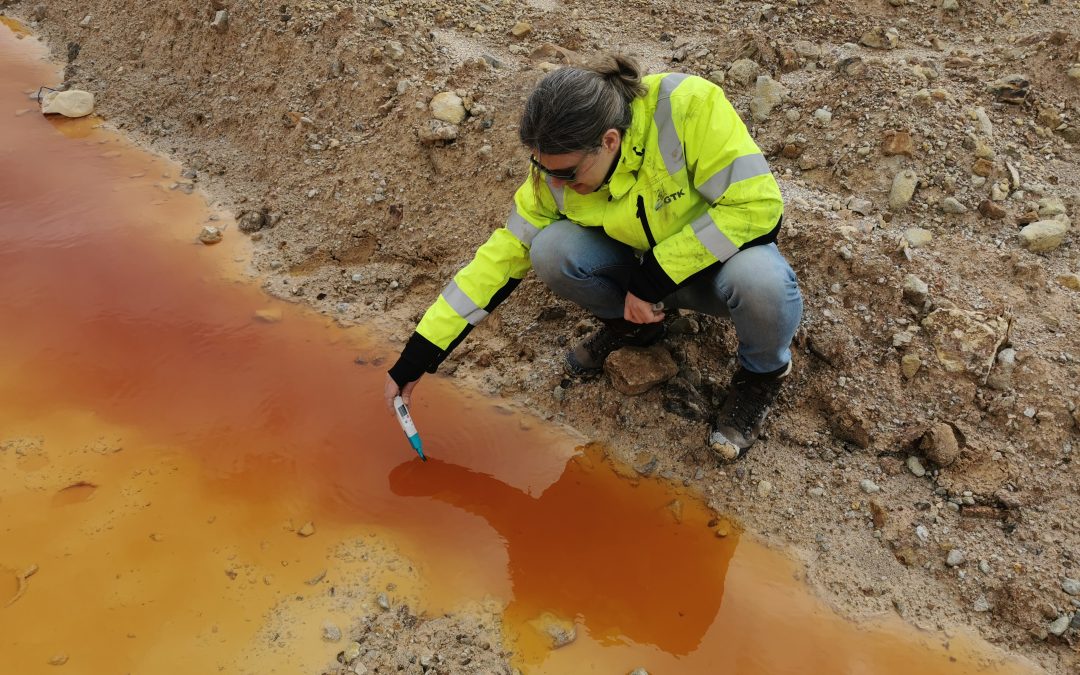
Deploying Smart Sensors for Smarter Mining: Fieldwork in Roșia Poieni
On 20 May 2025, as GoldenRAM partner CUPRUMIN marked its 48th anniversary, consortium teams were on the ground at key locations, including the Roșia Poieni open pit, the Valea Șesei tailings pond, and the Valea Cuibarului secondary raw material deposit, in a mission...
Contact Us
For any inquiries or further information, please feel free to contact us using the form provided on this website. We welcome your questions and feedback.
Subscribe to our Newsletter

Follow Us
© GoldenRAM – All Rights Reserved