
GoldenRAM team members from VTT (Technical Research Centre of Finland Ltd) and GTK (Geological Survey of Finland) carried out environmental fieldwork in Sokli, Eastern Lapland from 28 July to 8 August 2025. This time, the focus was on vegetation: collecting in-situ data to support plant diversity modelling and habitat mapping with remote sensing technology. The campaign combined classical field botany with cutting-edge tools like Sentinel-2 imagery, high-precision GNSS, and drone-based imaging.
Mapping Biodiversity on the Ground
The primary goal of the fieldwork was to gather vascular plant species diversity data from two study areas: Pierkuli and Soklin Ahot. These observations will be used to train and validate a plant diversity prediction model built on time-series data from Sentinel-2 satellites.
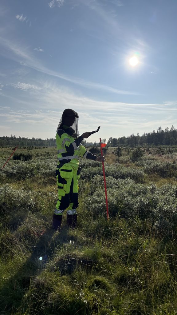
Pinja Lindgrén (VTT) geolocating a sampling plot at Soklin Ahot
Led by Pinja Lindgrén (VTT), a total of 62 sampling plots were established using stratified random sampling. Each plot was located with a handheld N80T South GNSS tablet providing 5–10 cm accuracy, later refined with a survey-grade RTK GPS.
A sampling plot consisted of 3 quadrats (1m x 1m) for detailed plant surveys, a relevé (10m x 10m) corresponding to a Sentinel-2 pixel, and marked plot corners for long-term monitoring.
Within each plot, biologist Lauralotta Muurinen (Albus Luontopalvelut Oy) identified all vascular species and visually estimated their percentage cover. Bryophyte and lichen cover were also estimated in species or morpho-group level. Quadrat and relevé assessments were performed separately to capture differences in species size and density. Additional data included average vegetation height and photographs for contextual analysis. These observations will later be transformed into biodiversity indicators, a key input for the GoldenRAM platform.
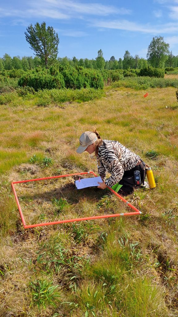
Lauralotta Muurinen estimating plant species coverage at Pierkuli
Adding a Bird’s Eye View
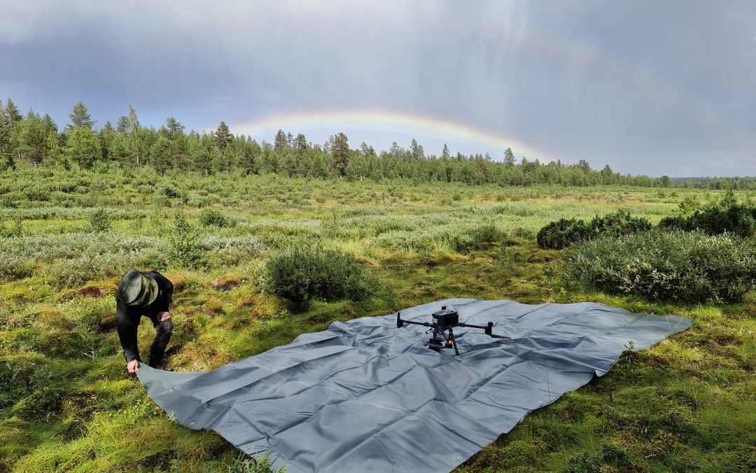
To complement ground surveys, auxiliary drone campaigns were carried out by Sami Siikanen and Timo Lind (VTT). Using a DJI RGB drone, our team collected orthophotos of each sampling plot at both 10 m x 10 m and 20 m x 20 m scales.
These high-resolution maps will support the interpretation of vegetation structure and species coverage, linking local field observations with broader-scale satellite data.
Tracking a Rare Species: Saxifraga hirculus
The Sokli campaign also included targeted monitoring of Saxifraga hirculus (lettorikko), a strictly protected species under the EU Habitats Directive (Annex IV), led by Oona Allonen (GTK). This plant thrives in nutrient-rich fens and spring areas, habitats shaped by Sokli’s unique geology.
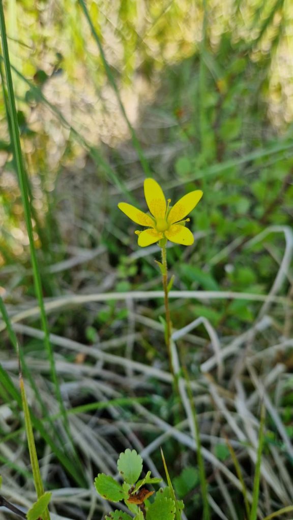
Saxifraga hirculus in bloom at Sokliaapa
Within the 20 km x 20 km Sokli study area, more than 460 observation points of Saxifraga hirculus were already known. Yet, during the campaign, the team discovered lettorikko on two previously undocumented sites in Sokliaapa, with 10 and 221 individuals each, adding 18 new observation points to the regional dataset.
Not all predicted sites yielded results, but the confirmed findings were significant. As one team member put it, “Finding two completely new areas for lettorikko in a mire that has been thoroughly surveyed before was a real thrill.”
What Comes Next
The Sokli vegetation dataset, enriched with both ground and drone observations, will serve as a training and validation resource for satellite-based biodiversity, species occurrence and habitatmodels. Together, these data streams will enhance GoldenRAM’s ability to monitor ecological impacts in mining regions, providing robust tools for sustainable land management.
Banner image: Timo Lind (VTT) preparing the RGB imaging drone at Soklin Ahot.