
Timely monitoring of tailings storage facilities is crucial for supporting structural integrity of dams, preventing environmental contamination, and complying with regulatory requirements.
Present monitoring tools often rely on field measurements and photogrammetric and airborne laser scanning campaigns. New opportunities are introduced by operationalising synthetic aperture radar (SAR) technology, recently enhanced with very high-resolution (VHR) imaging capabilities thanks to drone SAR and new generations of SAR satellites. Unlike optical sensors, SAR operates effectively in cloudy conditions and can partially penetrate vegetation cover. This enables frequent monitoring of both surface and subsurface conditions.
Within GoldenRAM, several Artificial Intelligence Knowledge Packs [1] (AIKPs) for tailings storage facility monitoring are developed that leverage multi-source EO datasets with key role of satellite SAR and drone SAR images as well as auxiliary drone thermal and multispectral optical image datasets. Given the rapid evolution of Large Language Models (LLM) and AI technologies, the AIKP concept has become increasingly prominent and highlights the foresight and innovation offered by the GoldenRAM project.
AI-Powered Insights for Water Levels and Moisture Monitoring
Two AIKPs under development are “Tailings storage facility (TSF) water level and volume calculation” AIKP and “Near-surface ground moisture retrieval” AIKP.
The first AIKP focuses on estimating water level and overall water volume in tailings storage facility ponds. The purpose of near-real-time monitoring is to ensure that the water level stays within planned optimal level. For example, if the hydraulic head of a tailings storage facility exceeds a critical level, the structure will become in danger of extensive seeping, deforming or even collapsing. High resolution satellite and drone SAR images are the primary data sources within this AIKP for water level determination, with a digital elevation model and bathymetric model of the pond floor to be used in water volume calculations. The service involves thematic mapping followed by water level retrieval and volume calculation. User-supplied Global Navigation Satellite System (GNSS) supported levelling data can be used for improved water delineation.
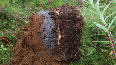
Composition of ground sample in vicinity of a TSF pond (image by: Maarit Middleton, GTK)
The second AIKP focuses on near-surface ground moisture retrieval to help identification of potential seepage and their extent. Volumetric moisture content is produced using satellite and drone SAR images and baseline physics-based and machine learning modeling approaches. User-supplied reference data can be used for finetuning the baseline models.
From Theory to Practice: Field Tests in Finland, Romania, and Portugal
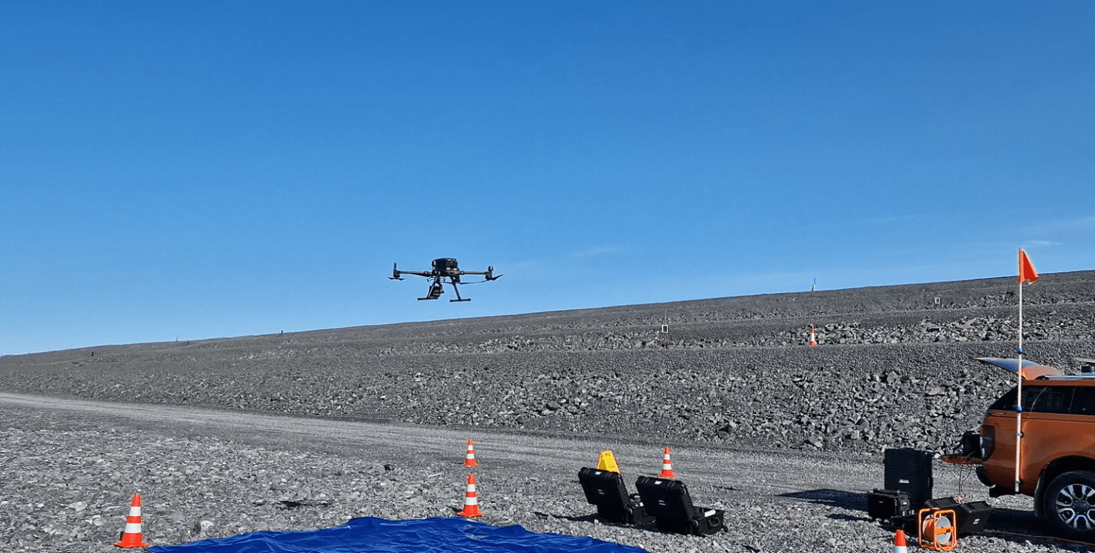
So far, user requirements have been collected and refined based on user interviews and follow-up bilateral meetings. Specifications of both AIKPs were performed and software implementation is ongoing. To support AIKP development, implementation and validation, a 1st field campaign was organised in Kevitsa, northern Finland, in August 2024. Further ground measurement and drone image collection campaigns are planned in Abrud mine site in Romania and Barroso mine site in Portugal during spring 2025.
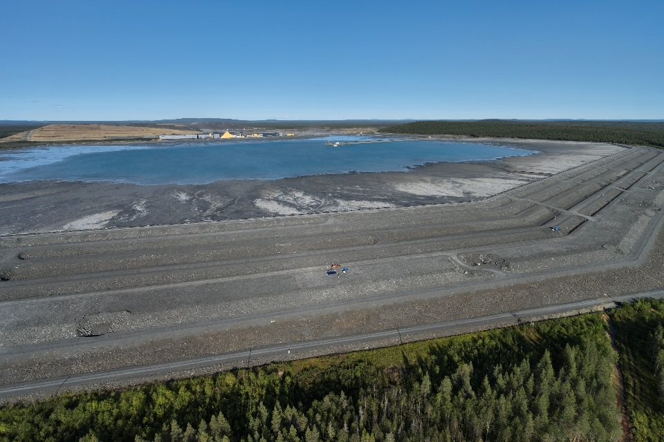
Kevitsa Mine tailing pond area is seen from VTT’s video drone. Pond itself at top, dam in the middle and nearby forest area in bottom of the image. (image by: Sami Siikanen and Timo Lind, VTT)
The collected earth observation datasets include satellite and drone SAR images as well as auxiliary optical and thermal imagery. Field datasets include soil-moisture sensor measurements, laser scanning datasets, water-level field measurements and laser scanning based estimates of water extent.
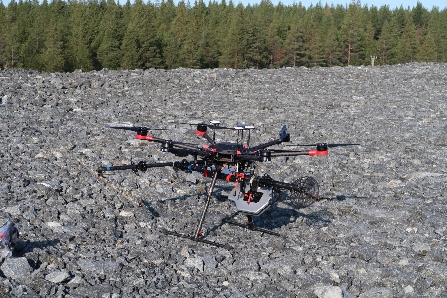
Radaz multi-frequency SAR drone instrument (image by: Maarit Middleton, GTK)
Next Steps: Towards Operational Deployment
GoldenRAM brings the very high-resolution (VHR) satellite and drone SAR data processing for operational use for mining industry. The complicated SAR image processing pipelines and machine learning tools are implemented to the platform environment. These open-source tools are placed on the GoldenRAM platform, after carefully checking licence conditions. Water extent and water depth – drone SAR derived products are produced and validated against field water level and depth measurements performed at the Kevitsa mine tailings. Validation results will be reported and presentation materials for product marketing will be produced. A bathymetric module will be applied and used with a drone to extract the real depth of the Tailing Pond Valea.
By pioneering SAR-based monitoring solutions, GoldenRAM is establishing new approaches in TSF safety and environmental management.
[1] AI Knowledge Packs (AIKPs) are modules within the backend component (OCLI) of the GoldenRAM platform. They streamline data operations, and enable efficient handling and analysis of diverse datasets for informed decision-making. In addition, they handle data acquisition, image preprocessing, generating analysis-ready data cubes, facilitating multi-source data fusion and AI analytics. Learn more here: https://goldenram-project.eu/technologies/