
Can acid mine drainage (AMD) be reliably detected from space by linking field mineralogy with satellite observations? This question lies at the core of GoldenRAM’s environmental monitoring approach, linking field mineralogy with satellite observations to enable scalable, remote assessment.
In August 2025, GoldenRAM partners CUPRUMIN, the Technical University of Cluj-Napoca (UTCN), VTT, and GTK conducted a field campaign at the Roșia Poieni copper mine near Abrud, Romania. The aim was to connect ground-based mineralogical data with satellite imagery and evaluate the feasibility of satellite-based AMD detection.
Sampling on a Sentinel-2 Satellite Grid
The waste dump at Roșia Poieni contains overburden and mine waste rock. AMD precipitates are widespread across its surface. To ensure robust spatial representation, the team designed a sampling strategy aligned with Sentinel-2 satellite data.
Using a maximum spatial coverage algorithm, 20 sampling points were distributed across the site. The grid spacing was set to 10 metres, matching the spatial resolution of Sentinel-2 imagery. This ensured that each field sample corresponds directly to a satellite pixel. Accessibility and safety were also considered, with sampling points limited to areas of manageable slope.
All sampling locations were pre-integrated into the GoldenRAM platform. This enabled efficient navigation and coordination in the field using orthophoto maps.
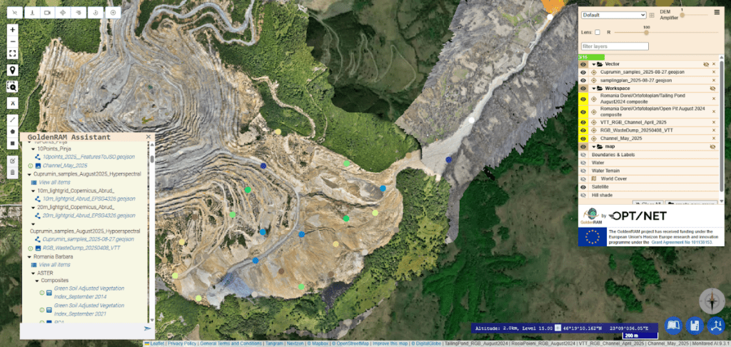
Sampling locations integrated into the GoldenRAM platform, enabling efficient field navigation via orthophoto maps
At each sampling location, a central sample was collected for X-ray diffraction (XRD) analysis to determine the mineralogical composition. To capture spatial variability within each satellite pixel, four additional measurements were taken approximately 2 metres from the centre in the north, south, east, and west directions. Hyperspectral data were acquired at each of these points using a VNIR–SWIR spectrometer under natural sunlight conditions. This resulted in five spectral measurements per pixel and enabling robust spectral characterisation. In parallel, pH values were recorded using a WTW pH meter equipped with a Hamilton Flatrode electrode.
The collected XRD samples were subsequently sent to GTK’s laboratory in Espoo, Finland, for semi-quantitative mineralogical analysis. The overarching objective is to correlate laboratory-derived mineralogical composition with field hyperspectral signatures and multispectral satellite data from Sentinel-2. Establishing consistent relationships across these three scales would provide a strong foundation for reliable satellite-based detection of acid mine drainage.
Early Observations from the Field
While laboratory results are still being processed, initial observations from the field already provide valuable insights. pH values of approximately 3.5 were recorded at 19 out of the 20 sampling locations, indicating strongly acidic conditions. These values are consistent with the formation of typical AMD minerals such as jarosite and schwertmannite. Visual inspection further confirmed the widespread presence of these precipitates across the waste dump. Together, these early findings highlight the strong potential for identifying AMD-related mineral signatures through spectral data.
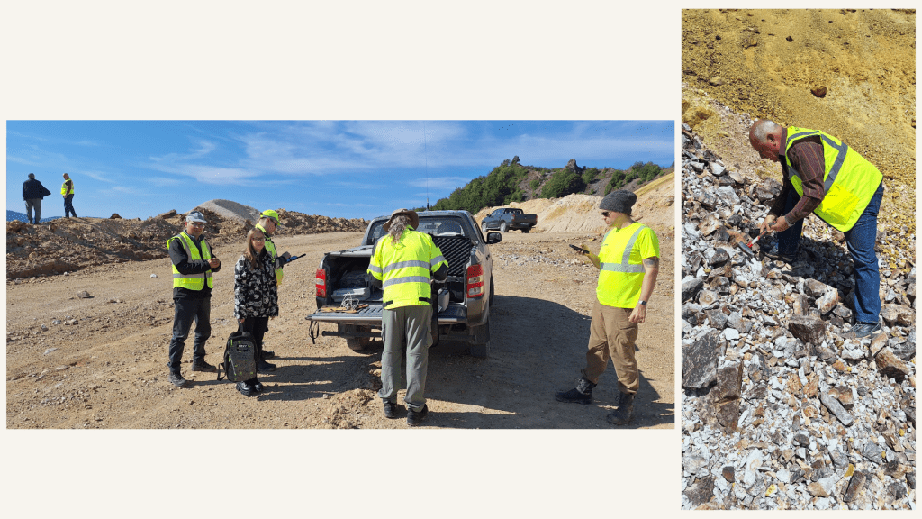
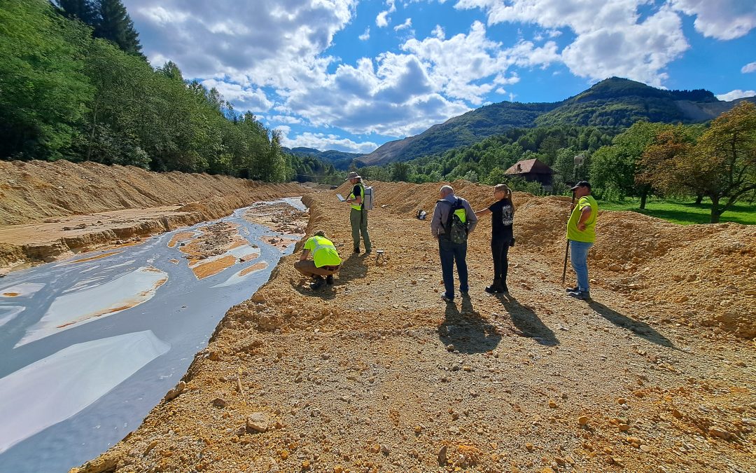
Members of CUPRU MIN, UTCN, VTT and GTK to survey, collect and assess the probes in the collector channel and secondary raw deposit
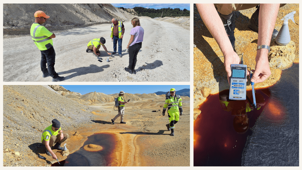
In situ pH measurements of the surface water and from the waste dump to be correlated with hyperspectral and XRD measurements
Ensuring Data Quality in the Field
Hyperspectral measurements were conducted using sunlight as the illumination source, which required careful calibration to account for variations in solar angle, atmospheric conditions, and shadow effects. To ensure data consistency and reliability, a standardised field protocol was followed throughout the campaign. This included the use of calibration targets, consistent spectrometer setup and configuration, and systematic procedures for pH measurements and soil sampling. These measures ensured that all collected data are comparable and suitable for further analysis.
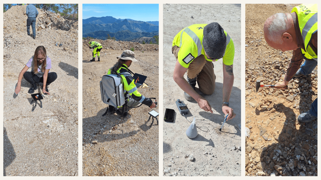
Field work protocol: setting up calibration target, VNIR-SWIR field spectrometer, pH measurements, and soil samples
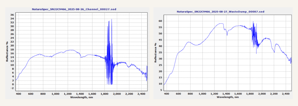
Example spectra measured in field
Acknowledgements
This campaign was made possible through the strong collaboration between GoldenRAM partners. Special thanks to CUPRUMIN for site access and logistical support, and to colleagues from CUPRUMIN and UTCN for their dedication during fieldwork.