GoldenRAM’s proceedings paper offering an in-depth look at how thermal drone imaging can support safe and sustainable mining operations in Europe is now publicly available. The study, featured in the SPIE Thermosense: Thermal Infrared Applications XLVII proceedings, presents the results and insights from a multi-sensor drone campaign at Boliden’s Kevitsa Mine in Finland.
The Challenge: Detecting Hidden Seepage
Tailing ponds are essential but potentially risky components of mining operations. If seepage goes undetected, it can lead to environmental contamination or even structural failure. Traditional inspection methods often fall short, thermal drones fill this gap by identifying surface temperature anomalies that may indicate leaks or moisture penetrating tailing pond dams invisible to the naked eye.
The Kevitsa Mine Field Campaign
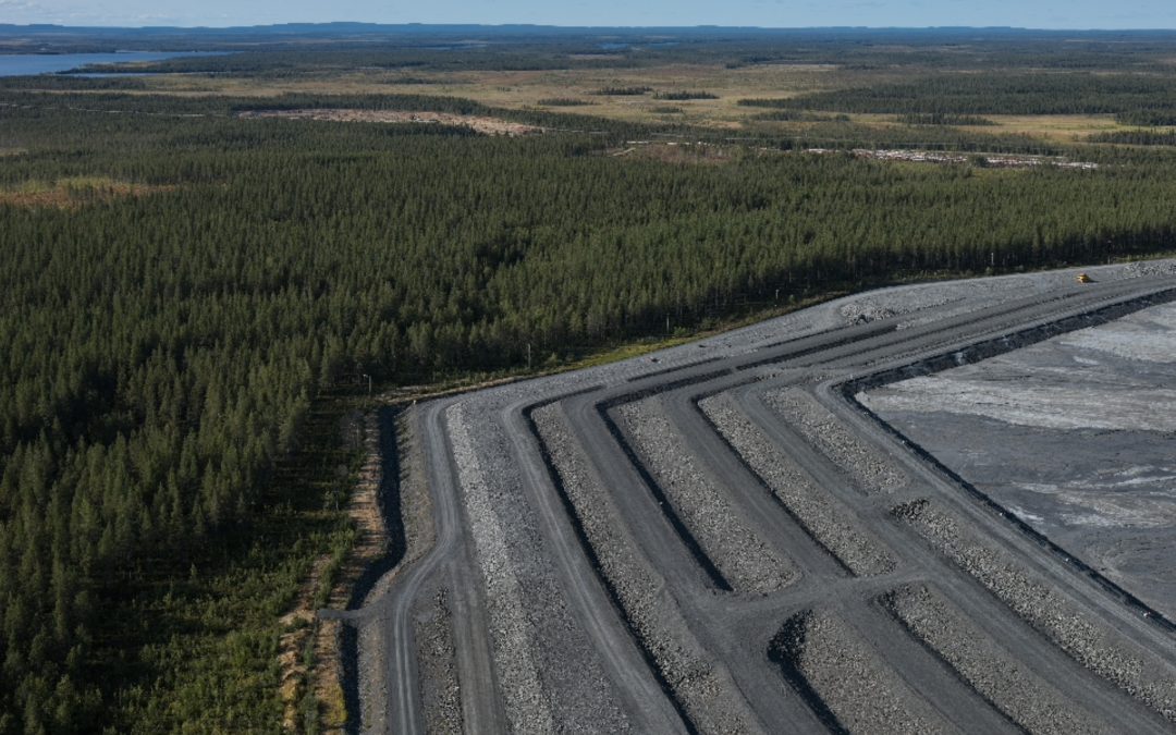
Between 19 and 23 August 2024, VTT Technical Research Centre of Finland and project partners Boliden and GTK conducted a drone-based imaging campaign at the Kevitsa site. Key objectives included monitoring for seepage in tailing pond dams, mapping ground moisture levels and assessing water quality in nearby Satojärvi Lake.

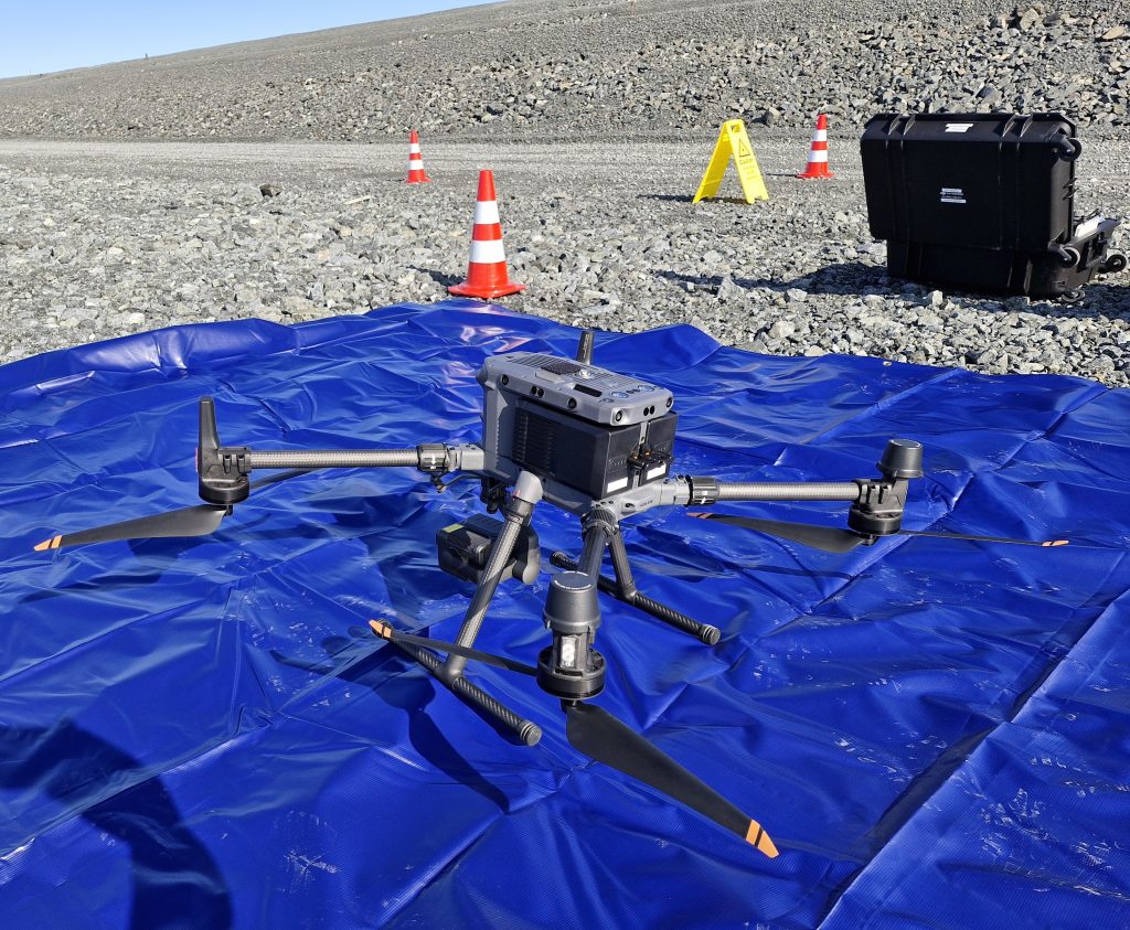
VTT’s thermal imaging drone is prepared for an imaging mission in a ground base in Boliden Kevitsa Mine tailing pond dam on 20th August 2024.
As a part of the campaign, thermal flights using a DJI M350 RTK drone equipped with a Zenmuse H20T infrared & RGB camera were conducted over the dam, adjacent forest, and lake shore. Real-time kinematic (RTK) positioning ensured high geolocation accuracy, and multiple battery sets enabled extended missions across large areas.
What Did We Find
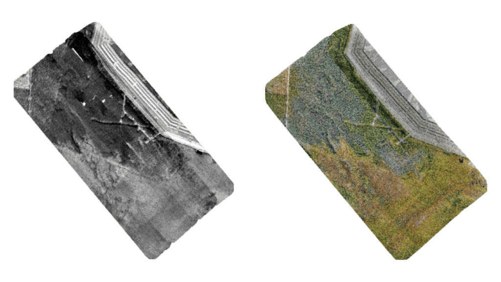
Hundreds of thermal images were processed into orthomosaics using Pix4D and ENVI software. These mosaics are used to reveal cool spots (around +4°C) along the dam, that could, in the future, be interpreted together with other sensor data to indicate seepage. RGB mosaics were also produced to support interpretation.

On the left: Resulting thermal orthomosaic of Kevitsa Mine tailing pond dam and forest area next to it. On the right: corresponding RGB orthomosaic of the same tailings dam and forest area.
To find areas with seepage, the thermal results will be integrated with other sensor data, including drone-borne synthetic aperture radar (SAR), ground-based moisture sensors, and lab-tested water samples, to offer a multi-layered understanding of tailing pond conditions.
Though the imaging itself was successful, the team encountered challenges during data processing—highlighting the need for improved workflows and user-friendly tools, especially when working in forested and generally moist environments with limited visual tie points.
What’s Next?
This campaign demonstrated the viability of using thermal drones for environmental monitoring in active mining operations. Looking ahead, the GoldenRAM vision includes developing automated, scalable systems, possibly swarms of autonomous thermal drones, that can deliver early warnings of seepage risks while reducing human intervention and increasing safety.
Read the Full Study
For those interested in the technical details and scientific approach behind the campaign, the full SPIE proceedings paper is now publicly available: Experiences from thermal drone imaging field campaign for developing automated tailing pond monitoring Siikanen, S., Lind, T., Ronne, E., Kauppinen, T., Savolainen, M., & Paavola, M. (2025). Thermosense: Thermal Infrared Applications XLVII. DOI: 10.1117/12.3053573

