The GoldenRAM platform is designed to transform the way industries interact with geospatial intelligence. Through innovative features and AI-driven tools, it makes navigating complex datasets intuitive, actionable, and more effective than ever before. Here’s an overview of its key assets and how they empower users across industries.
Accessible Geospatial Intelligence with AI
GoldenRAM’s AI-powered Graphical User Interface (GUI), developed with IBM Watson, simplifies this Navigating and analysing geospatial data. Acting as a GEO AI Assistant, the GUI enables natural language queries such as “show me,” “near,” and “between” for swift and precise data retrieval. This user-friendly platform organises geospatial data into intuitive tree-like folder and table views, allowing users to make faster, informed decisions.
By integrating high-resolution satellite data, the platform supports detailed mapping and terrain analysis over extensive and remote areas, revolutionising workflows for industries like mining. Users can now access geospatial data with ease, enhancing processes for sustainability, safety, and efficiency.
Volume Change Monitoring with AI Knowledge Pack (AIKP)
Tracking volume changes in landscapes is crucial for industries such as mining, construction, and environmental monitoring. GoldenRAM’s Volume Change Monitoring AIKP provides high-precision visualisation of Digital Elevation Model (DEM) data, including isoline delineation.
With seamless integration of DEM layers sourced from technologies like LIDAR and photogrammetry, users can track and display volume changes in an interactive 3D view. This layered structure enhances insights by enabling users to toggle between datasets, offering a comprehensive perspective that significantly improves decision-making.
Intuitive and Actionable Geospatial Data
GoldenRAM’s AI-driven platform transforms how users engage with geospatial intelligence by offering tools that simplify complex datasets. Key features include:
- Interactive Layers and Dynamic Map Information: Visualise up to 32 layers of geospatial data simultaneously, adjusting brightness, contrast, and transparency or re-ordering layers through an intuitive drag-and-drop interface.
- Widgets: Display essential details such as zoom levels, scales, and geographic coordinates.
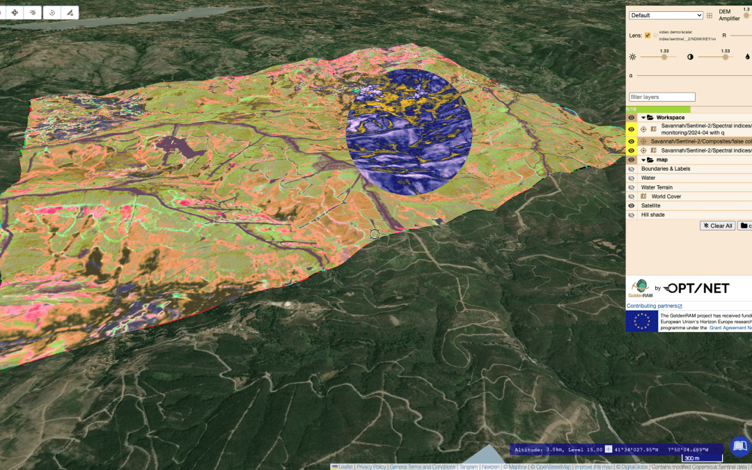
- Lens and Multilens Tools: Inspect overlapping datasets with precision, revealing hidden patterns and enhancing analysis.
- 3D Visualisation and DEM Amplification: Explore terrain with 3D tools that amplify subtle topological changes and provide a fully immersive perspective through Globe view.
- Drawing Tools and Area Selection: Select areas of interest directly on the map using lines, polygons, or rectangles, and export them as KML or GeoJSON files for further analysis. The platform also supports loading local files for seamless workflow integration.
Harnessing Sentinel-2 Data with Advanced AI Knowledge Packs
GoldenRAM leverages Sentinel-2 open optical multispectral data through a suite of AI Knowledge Packs (AIKPs), making environmental insights accessible and actionable. These tools are essential for applications in mineral exploration, agriculture, and environmental monitoring. Here’s a glimpse of just some of the already existing AIKPs:
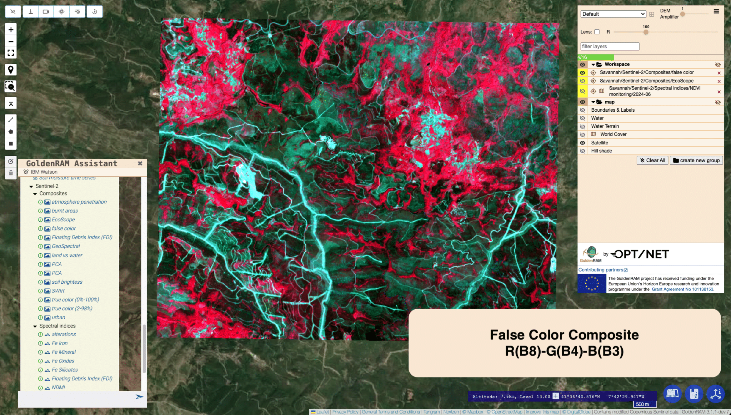
- Simple RGB Composites: Using False Colour Composites (R(B8)-G(B4)-B(B3)) to highlight vegetation health, with denser vegetation appearing red due to the near-infrared (B8) band.
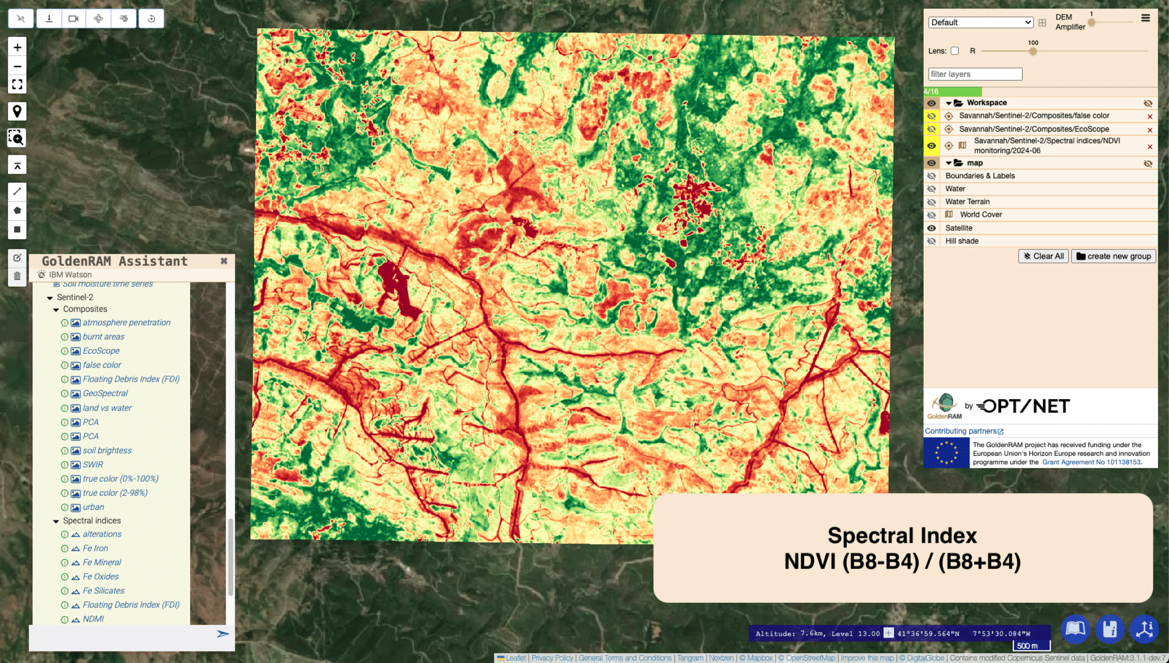
- Spectral Indices: Arithmetic expressions like the Normalised Difference Vegetation Index (NDVI) derive critical insights into vegetation health, land cover changes, and environmental conditions.
- Advanced Composite Visualisation: Sophisticated visuals integrating NDVI, NDWI (Normalised Difference Water Index), and MNDWI (Modified Normalised Difference Water Index) provide multi-faceted assessments of vegetation, soil moisture, and water bodies.


Each visualisation is generated through dedicated AIKPs, ensuring seamless access to complex analyses via user-friendly interfaces. As the GoldenRAM project progresses, even more advanced AIKPs are in development, promising to unlock deeper geospatial insights.
Driving Innovation in Geospatial Intelligence
GoldenRAM stands at the forefront of geospatial intelligence, empowering users with cutting-edge tools for analysis and decision-making. By combining advanced AI technologies, intuitive interfaces, and seamless integration of geospatial data, it offers a comprehensive platform that enhances sustainability and operational efficiency across diverse industries.

