
From Sokli to Kevitsa: In-Situ Water Quality Measurements in Finland’s North
In August 2025, GoldenRAM continued its environmental monitoring efforts with two fieldwork campaigns in northern Finland: first in Sokli (5–7 August), followed by Kevitsa (18–22 August), both carried out by GTK the Geological Survey of Finland, and coordinated by Hannu Panttila (GTK). These activities build on the work conducted in 2024, which included drone-based imaging and water quality assessments near the Kevitsa Mine.
The primary objective of the 2025 campaigns was to carry out extensive in situ water quality measurements from strategically selected lakes near mining or exploration sites. These measurements help calibrate and validate satellite and drone-based remote sensing methods for environmental monitoring. Data collected will be used to monitor ecological changes over time—particularly focusing on chlorophyll concentration, turbidity, and potential contamination linked to nearby mining operations.
Sokli, Finland – Measuring Water Quality Near a Phosphorus Ore Deposit
Our team’s first stop in August was Sokli, located in Eastern Lapland. The area is home to a significant phosphorus ore deposit, making it a prime candidate for water quality monitoring as part of GoldenRAM’s broader environmental objectives.
Measurements were conducted on two lakes, Lake Loitsana, located adjacent to the ore deposit, a lake of particular interest due to its proximity to the potential mining site, and Lake Ainijärvi, located approximately 8 km from Loitsana. Ainijärvi serves as a reference lake with less human influence.
Despite the upgrade from last year’s canoe to a small rubber boat, navigating Lake Loitsana remained challenging due to a surge in thick aquatic vegetation. However, the full length of the lake was successfully measured and logged.
In contrast, Lake Ainijärvi with its sparse vegetation allowed for the use of an electric engine, and the team completed four full-length measurement runs with ease.

Antti Kuisma (GTK) checking the measurements at Lake Ainijärvi, with an osprey (Pandion haliaetus) soaring in the sky behind him.
Kevitsa, Finland – Return to Lake Saiveljärvi
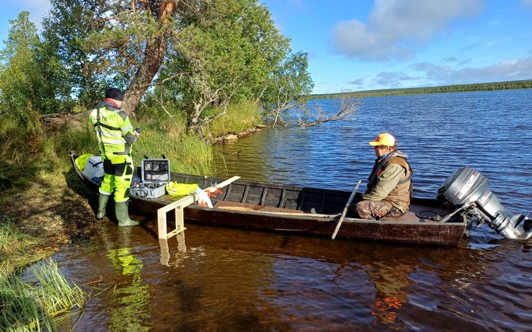
Two weeks after Sokli, the team returned to Lake Saiveljärvi near the Boliden Kevitsa mine, continuing the work started in 2024. This time, a large, wooden river boat, expertly piloted by a long-time local fisherman Jorma Kaaretkoski, allowed avoiding dense vegetation zones and optimising the measurement path.
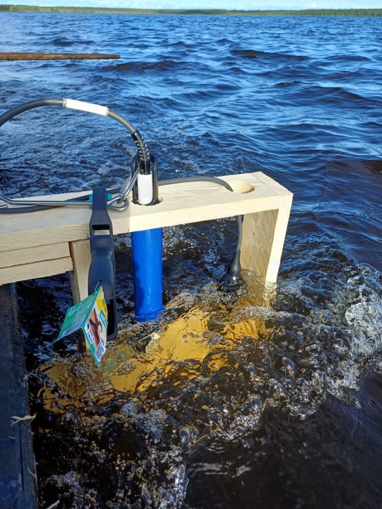
To further improve data quality, a custom wooden mount for the water quality sensors built by Riku-Olli Valta (GTK) reduced the need for manual handling. Periodic stops were nevertheless required to clear plant material from the sensors, which, when ignored, could lead to spurious chlorophyll readings due to interference.
Measurements ongoing over 13 kilometers of the lake Saiveljärvi.
Despite the occasional detours to clean equipment, the measurement campaign was a success. Data was collected at 15-second intervals along a 13 km route—covering the lake’s length comprehensively. Post-processing will now begin, where the team will remove any faulty readings caused by sensor collisions with aquatic vegetation. This curated dataset will be handed over to Pinja Lindgrén and Matthieu Molinier (VTT Technical Research Centre of Finland Ltd) for further analysis with satellite images.
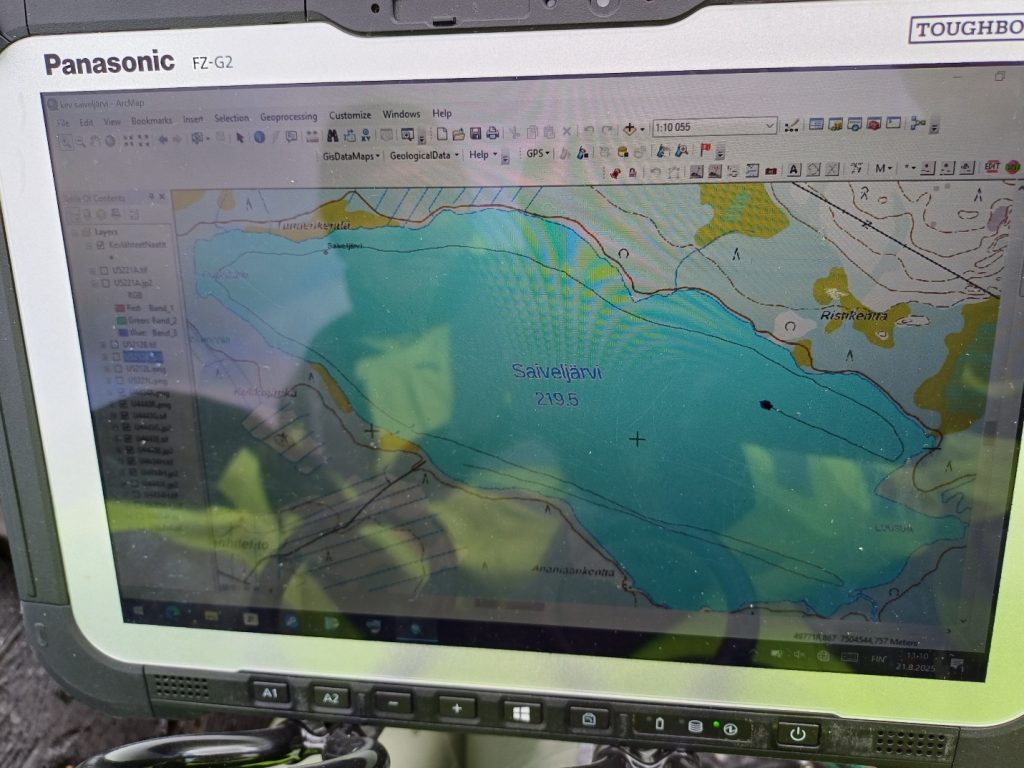
Onboard tablet displaying real-time route mapping using ArcGIS.
What Comes Next?
These in situ measurements will feed into a multi-modal monitoring system integrating drone, satellite, and in situ sensors. Ultimately, the GoldenRAM project seeks to develop tools that can detect and monitor environmental impacts from mining activities in near real-time, supporting both sustainable resource use and community transparency.
Banner image: Riku-Olli Valta (GTK) and Jorma Kaaretkoski preparing the wooden boat for measurements. Its stability made it ideal for scientific work.